


Oxford DIY Walking Tour (circular): Oxford Railway Station > Ashmolean Museum of Art and Archaeology > Oxford University Museum of Natural History > Pitt Rivers Museum > Sheldonian Theatre >...
Further Details> Oxford DIY Walking Tour Route Map <
Distance: 6.5 km (just over 4 miles); Duration: 2-8 hours
Highlights: Oxford Railway Station > Ashmolean Museum of Art and Archaeology > Oxford University Museum of Natural History > Pitt Rivers Museum > Sheldonian Theatre > Bodleian Library > Bridge of Sighs > New College > Radcliffe Camera > Magdalen College & Chapel > Magdalen Bridge (Boat Hire) > Oxford Botanic Garden and Arboretum > Carfax Tower > Christ Church > Christ Church War Memorial Garden > Christ Church Visitors Centre > Christ Church Meadow Walk (optional) and returning to Oxford Railway Station.
This circular DIY Walking Tour of Oxford is 6.5 kilometres long (just over 4 miles). And as “normal” walking speed is around 7kph/4mph, this is a very easy 2 hour walk (allow for a whole day though – as this will give you plenty of time to visit some of the best attractions in Oxford as you go).
The Oxford DIY Walking Tour step-by-step walking instructions are detailed below. And, as many visitors to Oxford will arrive by train (especially in the case of wheelchair users – as the train is accessible), I have used Oxford Railway Station as the start and end points for this circular DIY Walking Tour of Oxford.
And, being a circular route, you can start/end the Oxford DIY Walking Tour at any point (depending on the location of your central Oxford hotel perhaps?).
But, because it is indeed a circular route, theoretically it can be made in either direction. But I would definitely recommend following this route around Oxford in a clockwise direction. And for two reasons:
1. The very first Oxford attraction you come to will be the Ashmolean Museum of Art and Archaeology. And as the Ashmolean is the #1 visitor attraction in Oxford city centre, then it means that your Oxford DIY Walking Tour starts with a bang;
2. And the more outdoor section of the route around Oxford will be later in the day, when it should be warmer (including an optional 1-hour stroll around Christ Church Meadow Path, along the River Cherwell, and briefly, the River Thames – this path is accessible when reasonably dry).
Oxford DIY Walking Tour: Walking Directions
These are very thorough walking directions – you shouldn’t be getting lost in Oxford when following this guide.
However, I definitely recommend that you follow the Google Streetview route of the entire Oxford DIY Walking Tour first, from the comfort of your own home before you even head to Oxford, as this will allow you to better visualise the entire route before you arrive.
START: Oxford Railway Station
[MAP]:
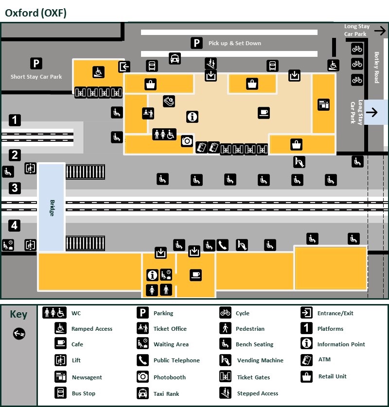
Toilets (including an accessible toilet) are located on the main concourse of Oxford Railway Station. And as accessible toilets are few and far between on this route (outside of each attraction), then I seriously recommend using the facilities here first, before you embark on your DIY Tour of Oxford.
On exiting the station, you will find that there are steps down from the main entrance of Oxford Railway Station. However, there is also a ramp on either side of these steps.
Once down, there are two ways to reach the main road from here, but the surface of the pavement directly to your RIGHT is much easier (the crossing directly in front of the main entrance to Oxford Railway Station is rather bumpy). So:
At the foot of the steps in front of Oxford Railway Station, immediately turn RIGHT, and follow the pavement around to another pedestrian crossing (the path turns left, and then right).
Pedestrian Crossing [MAP]:
At the end of the crossing, turn RIGHT, walk for a few metres, then turn LEFT when you reach the main road (called Park End Street here). And continue STRAIGHT AHEAD, crossing Rewley Road and Hythe Bridge as you go, until you finally arrive at the junction with Worcester Street.
Worcester Street [MAP]:
Turn LEFT, and continue along the LEFTHAND pavement of Worcester Street, until Worcester Street bends to the right. At this point, you will see another pedestrian crossing (which will take you across Walton Street – which branches off of Worcester Street).
At the end of the crossing, continue STRAIGHT AHEAD/RIGHTISH (now along the LEFTHAND pavement of Beaumont Street), until you see the steps leading up to the Ashmolean Museum, on your LEFT.
Ashmolean Museum of Art and Archaeology
[MAP]:
Entry to the Ashmolean Museum is free, but pre-booking is required for groups.
The Ashmolean Museum is accessible too (including 4 accessible toilets). The rooftop restaurant and terrace is accessible too.
Plan your visit via the official Ashmolean Museum website.
Although there are steps leading to the main entrance here, there are also accessible ramps on either side.
The entrance has a revolving door too. But there is also an automatic door for wheelchair access.
After visiting the Ashmolean, at the foot of the steps, turn LEFT, and walk to the corner (with St.Giles’), where it’s Decision Time:
1. Either, turn LEFT, and continue along the lefthand pavement of St.Giles‘; or
2. For a shorter route, but one which misses out on BOTH the Oxford University Museum of Natural History and the Pitt Rivers Museum (two of the most popular visitor attractions in Oxford), turn RIGHT, and cross the end of Beaumont Street using the pedestrian crossing, and head directly to the Sheldonian Theatre and the Bodleian Library (*this “Shortcut” is explained in detail at the end of these Walking Directions for the longer Oxford DIY Walking Tour).
So, to continue on the longer route:
Turn LEFT at the junction of Beaumont Street and St.Giles’, and follow the LEFTHAND pavement of St.Giles’, for a LONG way until you arrive at the pedestrian crossing (just after Little Clarendon Street) .
Pedestrian Crossing [MAP]:
At the end of the crossing, turn LEFT, and immediately turn RIGHT, and follow the path that runs beside St Giles’ Church (the church building will be on your LEFT, and the graveyard will be on your RIGHT).
St Giles' Church
St Giles’ Church is one of the oldest and most historically significant parish churches in Oxford (dating back to the early 12th century and completed around 1120).
At the end of the footpath, after passing the church building, turn RIGHT, and you will immediately see another light-controlled pedestrian crossing.
Pedestrian Crossing [MAP]:
At the end of this crossing, turn LEFT, and immediately turn RIGHT, and continue along the RIGHTHAND pavement of Keble Road (crossing the tiny Blackhall Road along the way (there are dropped kerbs here if needed), and passing the wonderfully ornate Keble College and Keble College Chapel), until turning RIGHT at the end of Keble Road (at the junction with Parks Road).
Turn RIGHT at the junction, and you will immediately see a light-controlled pedestrian crossing on your LEFT.
At the end of the crossing, turn RIGHT, and continue until you see the entrance to the Oxford University Museum of Natural History and the Pitt Rivers Museum on your LEFT (they both share the same entrance).
Oxford University Museum of Natural History & Pitt Rivers Museum
[MAP]:
Both Museums are accessed by the same main entrance. The accessible entrance is further down to your RIGHT.
Established in 1860, the Neo-Gothic Oxford University Museum of Natural History houses Oxford University’s extensive zoological, entomological, geological, and paleontological collections – and serves as both an educational hub and architectural icon.
Plan your visit via the official Oxford University Museum of Natural History website.
Accessibility at the Oxford University Museum of Natural History.
The Pitt Rivers Museum is one of Oxford’s most distinctive attractions and is renowned for its anthropology and archaeology collections. Founded in 1884 with the donation of General Augustus Pitt Rivers’ collection to the University of Oxford, it now houses more than 700,000 objects, photographs, and manuscripts from around the world.
Rather uniquely, objects are traditionally displayed by type or function (rather than by culture or geography), creating striking comparisons between societies across the world.
Plan your visit via the official Pitt Rivers Museum website.
Accessibility at the Pitt Rivers Museum.
After exiting the museums, return to Parks Road, turn LEFT (so that you are heading in the same direction as before), and continue along the LEFTHAND pavement of Parks Road, crossing many sideroads as you go, until you see the unmarked crossing on your right, outside of the King’s Arms pub.
After crossing Parks Road here, turn LEFT, and then immediately turn RIGHT, where you will see the next unmarked crossing that will take you across Broad Street.
At the end of this second crossing, turn RIGHT, and, after passing the stunning Clarendon Building, you will see the rear entrance to the Sheldonian Theatre.
Sheldonian Theatre (rear entrance)
[MAP]:
Once through the gate (or door if you used the accessible entrance), pass by this side of the Sheldonian Theatre, turn LEFT, and walk to the main entrance.
Accessibility Information: There are steps at the main entrance here, but there is also an accessible entrance to the Sheldonian Theatre just a few metres further back (on the side that you have just passed). The door of this accessible entrance is sometimes locked though. If this should be the case when you visit, simply enquire at the main entrance (an assistant may have to do this for you though). Once inside, it is only the ground level that is accessible anyway.
Designed by Sir Christopher Wren, the striking Sheldonian Theatre is one of Oxford’s most famous buildings and serves as the ceremonial hall of the University of Oxford.
Climb the 114-step 17th century staircase (so not accessible unfortunately), to reach the cupola – one of the best viewpoints in central Oxford.
Plan your visit via the official Sheldonian Theatre website.
Accessibility at the Sheldonian Theatre.
After your visit to the Sheldonian Theatre, continue along the front of the building, then turn into the courtyard that runs between the Clarendon Building and the Bodleian Library.
Turn RIGHT when you reach the middle of the courtyard, and continue through the archway into the Bodleian courtyard.
Bodleian Library
[MAP]:
The Bodleian Library is the main research library of the University of Oxford and one of the oldest libraries in Europe. It is also one of the largest libraries in the UK, holding millions of printed items, manuscripts, maps, and archives.
The Bodleian receives a copy of every new book published in the UK and Ireland.
Plan your visit via the official visit Bodleian Library website.
Accessibility at the Bodleian Library in Oxford.
After passing through the side archway into the central courtyard of the Bodleian, you will see the Statue of William Herbert, Earl of Pembroke on your RIGHT.
Turn LEFT, and exit via the main entrance of the Bodleian Library.
At the exit (entrance?), continue STRAIGHT AHEAD, until you reach the far pavement (as there’s a dropped kerb here – outside of the entrance to Hertford College), turn LEFT, and continue along the RIGHTHAND pavement of Catte Street. When you reach the first corner (into New College Lane), instead of immediately turning right, continue across New College Lane until you reach the far pavement, and THEN turn RIGHT.
Bridge of Sighs
[MAP]:
After turning, you will be confronted with one of THE best sights in Oxford:
The Bridge of Sighs is one of Oxford’s most photographed landmarks. Officially called Hertford Bridge, it connects two parts of Hertford College across New College Lane.
The nickname comes from its resemblance to the famous Bridge of Sighs in Venice. Unlike the Venetian bridge, however, Oxford’s version was never associated with prisons or condemned prisoners (a popular myth claims that students crossing the bridge were sighing over difficult examinations, but this is just a local legend).
A wee bonus: not only will you see the Bridge of Sighs – you will actually pass below it!
And it leads to one of Oxford’s hidden gems.
Simply continue along this LEFTHAND pavement of New College Lane, following the lane as it curves RIGHT, then LEFT, until you reach the unassuming side entrance to New College.
New College
Pass through this door into an Oxford wonderland (largely tourist-free):
PIC1 – the other side of that unassuming doorway;
PIC2 – the ramped entrance to New College Chapel & Cloisters;
PIC3 – entrance to the Garden Quadrangle;
PIC4 – The New College Garden (a world away from the Oxford tourist frenzy);
PIC5 – Looking back towards New College from New College Garden.
Plan your visit via the official visit New College website.
As New College is a place of study all year round, please don’t enter staircases, college rooms, or areas marked as private. And in the Garden, please keep off the grass (no picnics).
After your stroll around New College, simply retrace your steps, back under the Bridge of Sighs, turning LEFT into Catte Street again, and continuing along the LEFTHAND pavement of Catte Street until the end.
Radcliffe Camera
[MAP]:
After passing the traffic barrier, continue STRAIGHT AHEAD (with the Radcliffe Camera on your RIGHT).
Wheelchair users should remain on this side of the Radcliffe Camera (the Catte Street side), as there are cobbles on the other side.
Built between 1737 and 1749, the Radcliffe Camera is one of the most iconic buildings in Oxford, and a symbol of the University of Oxford. Its distinctive circular dome dominates the skyline around Radcliffe Square.
Access to the interior is generally restricted to library readers (the Radcliffe Camera functions as a reading room for the Bodleian Library) and guided tours.
Also, although the University Church of St Mary the Virgin cafe (which faces you) is step-free, this Radcliffe Square entrance has steps. So wheelchair users who wish to visit the cafe, and the church of course, will have to enter the University Church of St Mary the Virgin via the High Street entrance.
University Church of St Mary the Virgin
The University Church of St Mary the Virgin (often just called the University Church) is regarded as the spiritual heart of the University of Oxford.
If you have time to visit only one church in Oxford, then visit St Mary the Virgin – for its university history, and the exceptional panoramic views of Oxford from its tower (the tower is not accessible though).
Plan your visit via the official University Church of St Mary the Virgin website.
Accessibility at the University Church of St Mary the Virgin.
After your visit, turn LEFT, and head along the LEFTHAND pavement of High Street until you see the Visitor Entrance to Magdalen College on your LEFT (after crossing Longwall Street along the way).
Magdalen College & Chapel
[MAP]:
Accessibility: Although the majority of Magdalen College & Chapel is indeed accessible, there are steps at the main visitor’s entrance. However, step-free entry is available via the gate on the LEFT (Magdalen staff will open the gates for you – there is a bell push to contact the porter who can open the gates to give access).
Magdalen College is the home to another of Oxford’s gems: Addison’s Walk.
Because it can only be accessed by visiting Magdalen College first, Addison’s Walk is not overrun by the tourist hordes – so is a haven of tranquility.
Plan your visit via the official Magdalen College website.
Accessibility at Magdalen College.
After visiting Magdalen College, leave by the same entrance/exit as before, and turn LEFT when you reach the High Street again, and continue past the Magdalen Tower until you arrive at Magdalen Bridge.
Magdalen Bridge & Boat Hire
[MAP]:
Able-bodied visitors to Oxford can hire punts, rowing boats and pedalos here. If you plan on self-punting/rowing, then there is no need to book in advance (you just turn up and go – basic punting technique is explained where needed).
If you wish to just sit back and enjoy the river lazily flowing by though, a chauffeured punting service is also available. This has to be booked in advance though – using this online form.
After visiting Magdalen Bridge (and maybe even after enjoying an hour messing about on the river), retrace your steps, but only as far as Magdalen Tower. Just before you reach the Tower, you will see an unmarked pedestrian crossing on your LEFT.
At the end of the crossing, turn RIGHT, and then almost immediately you will see the entrance to the Oxford Botanic Garden on your LEFT.
Oxford Botanic Garden
[PIC]:
Founded in 1621, and containing more than 5,000 different plant species, the Oxford Botanic Garden is the oldest botanic garden in Britain and one of the oldest scientific gardens in the world. Historic walled gardens, herbaceous borders, water-loving plant collections and glasshouses with tropical rainforest, desert, and alpine plants.
Plan your visit via the official Oxford Botanic Garden website.
Accessibility at Oxford Botanic Garden.
Accessible entrance to the Oxford Botanic Garden: There are steps (down) at the main entrance to the Botanic Garden. However, an alternative step-free entrance is available. Simply continue past the main entrance, heading along this LEFTHAND pavement of the main High Street. Turn LEFT at the first corner, into Rose Lane, and again take the very first turning on your LEFT (be careful here – as you will be on the roadway for about 20 metres – there’s very little traffic here though).
After visiting the Botanic Garden, continue (for quite a long way) along this LEFTHAND pavement of High Street, until the junction with St.Aldate’s (the 12th-Century Carfax Tower will be on the opposite side of the road in front of you).
Carfax Tower & Christ Church
Carfax Tower is the surviving remnant of the medieval St Martin’s Church, which was largely demolished in 1896. The current tower dates mainly from the 13th century, with later additions and restorations.
Climb the 99 steps (not accessible) to the top for panoramic views of Oxford’s famous skyline.
After turning LEFT into St.Aldate’s at the junction, head along the LEFTHAND pavement of St.Aldate’s until you reach the Tom Gate entrance to Christ Church (this is the accessible entrance only though – the main entrance to Christ Church is at Meadow Gate on the Broad Walk).
Plan your visit via the official Christ Church Oxford website.
Accessibility at Christ Church Oxford.
After visiting Christ Church, and leaving by Tom Gate again, turn LEFT, and continue along St.Aldate’s for a few metres until turning LEFT again at the entrance to the Christ Church War Memorial Garden.
Christ Church War Memorial Garden
Created in 1926 to commemorate members of Christ Church who lost their lives in the First World War, the Christ Church War Memorial Garden is a peaceful memorial garden beside Christ Church College.
Accessibility: There are steps at the end of the garden, which lead up to the Broad Walk. However, there is also a ramp on the right here.
The surface of the Broad Walk path is hard earth and shingles. Relatively easy on a dry day.
Plan your visit via the official Christ Church Oxford website.
Accessibility at Christ Church Oxford.
After viewing the garden, continue in the same direction (i.e. away from the road), until you reach the Broad Walk path.
At the top of the steps/ramp, turn RIGHT, and head for the thatched Christ Church Visitors Centre.
Christ Church Visitors Centre
The Christ Church Visitor Centre is the main entry point for tourists visiting Christ Church College and Cathedral. It is located within Christ Church Meadow, a short walk from St Aldate’s, and was opened in 2020 in a restored historic thatched barn. The centre includes ticketing facilities, a shop, visitor information, toilets (including an accessible toilet), and exhibition space.
Plan your visit via the official Christ Church Oxford website.
Accessibility at Christ Church Oxford.
After visiting the Christ Church Visitors Centre, return to the Broad Walk path again.
You now have a decision to make (and the current, and recent, weather will decide this for wheelchair users):
1. Turn LEFT, and make your way back through the Christ Church War Memorial Garden, until you reach the main road again (St.Aldate’s); or
2. Turn RIGHT, and take the optional 40-minute stroll around the outside edge of Christ Church Meadow (this optional route takes you along the bank of the River Cherwell, and briefly takes you next to the River Thames too. A guide to this Christ Church Meadow Trail is available in the Visitors Centre – you can also download the online Christ Church Meadow Trail guide now).
Christ Church Meadow
[PIC]:
This is an excellent overhead photograph of the entire Christ Church Meadow area. On the bottom left you will see the thatched roof of the Christ Church Visitors Centre, and as you pan around, you will see the entirety of the Christ Church Meadow Trail route.
The route actually consists of different paths: the Broad Walk; LEFT into Grove Walk; RIGHT into Deadman’s Walk (which takes you around Merton Field); the Christ Church Meadow Walk (which runs beside the River Cherwell, until it joins with the larger River Thames); and returning via the tree-lined New Walk/Poplar Walk.
The entire route around Christ Church Meadow is blissfully traffic-free (after a while, the only sounds you will hear are the birds in the trees, the Longhorn cattle munching grass, and, when you reach it, the sound of the River Cherwell lazily lapping against the riverbank).
Optional Christ Church Meadow Walk - Directions:
1. When you rejoin the Broad Walk after visiting the Christ Church Visitors centre, turn RIGHT, and continue AWAY from the Christ Church War Memorial Garden, then turn LEFT into Grove Walk.
2. Turn RIGHT at the first corner, and pass clockwise around Merton Field using the Deadman’s Walk path.
3. Join the smaller Christ Church Meadow Walk path, as it follows the River Cherwell meandering downstream, until it meets, and you briefly walk beside, the River Thames.
3. Again, turn RIGHT here (now heading away from the River Thames, and follow the New Walk/Poplar Walk path to the very end (where it rejoins the Broad Walk path just by the Visitors Centre).
4. To return to the main Oxford DIY Walking Tour route, turn LEFT when you join the Broad Walk again, and retrace your steps back through the Christ Church War Memorial Garden.
Accessibility: All paths have a similar surface (hardpacked earth and shingles). The initial Broad Walk path, and the final Poplar Walk path are reasonably wide. However, the section by the River Cherwell is along the narrower Christ Church Meadow Walk path.
And all paths are accessible – in the dry. They can become rather muddy in places during wet weather though (or when it is currently dry weather, but it has rained in the last day or so).
My recommendation would be to follow the wider Broad Walk, Grove Walk & Deadman’s Walk paths until they end (where the path meets the River Cherwell), and then judge the state of the smaller Christ Church Meadow Walk path’s surface.
Once you reach the main road again (St.Aldate’s) after exiting Christ Church War Memorial Garden/Christ Church Meadow, turn RIGHT and retrace your steps back along the, now, RIGHTHAND pavement of St.Aldate’s, until you reach the junction with High Street again.
Just before the actual road junction, you will see a pedestrian crossing on your LEFT.
At the end of the crossing, continue STRAIGHT AHEAD along the partly-pedestrianised Queen Street. Just after you pass Bonn Square another pedestrian crossing will take you across New Road.
At the end of the crossing, turn RIGHT, and continue along the LEFTHAND pavement of New Street until you see Oxford Castle on your LEFT.
Oxford Castle & Prison
One of Oxford’s most fascinating historic attractions, Oxford Castle & Prison combines the remains of an 11th-century Norman castle with a former county prison that operated until 1996. The site offers over 1,000 years of history, from the Norman Conquest to Victorian justice and modern heritage preservation.
Plan your visit via the official Oxford Castle & Prison website.
Accessibility at Oxford Castle & Prison.
After visiting Oxford Castle & Prison, return to this same junction, turn LEFT, and continue along the LEFTHAND pavement of New Street. At the end of New Street, another unmarked pedestrian crossing will take you across Tidmarsh Lane towards Park End Street.
At the end of the crossing, continue STRAIGHT AHEAD, along the LEFTHAND pavement of Park End Street, until you reach the mini-roundabout and see another pedestrian crossing directly in front of you (it crosses Hollybush Row).
At the end of this first crossing, turn RIGHTISH, and head to the pedestrian crossing which will take you onto the pavement at the other side of Park End Street.
At the end of this second crossing, turn LEFT, and head along the RIGHTHAND pavement of Park End Street for a few more metres, until you see the turning into Oxford Railway Station on your RIGHT.
Back to where you started, at Oxford Railway Station.
YOUR DIY WALKING TOUR NOW ENDS
* That shortcut explained (but which misses out BOTH the Oxford University Museum of Natural History and the Pitt Rivers Museum – two of the most popular visitor attractions in Oxford):
After visiting the Ashmolean Museum, and heading to the junction of Beaumont Street and St.Giles’, instead of turning LEFT (and following the longer route as detailed above), turn RIGHT, and cross the end of Beaumont Street via the pedestrian crossing.
At the end of the crossing, continue STRAIGHT AHEAD , along the RIGHTHAND pavement of Magdalen Street (you will see the Martyrs’ Memorial and the entrance to Balliol College on the opposite side of the road), and continue until you arrive at the junction of Magdalen Street and Broad Street.
Your ultimate destination is the pavement outside of the Waterstones shop diagonally across from you. But to get there, you first need to continue STRAIGHT AHEAD and cross George Street, then immediately turn LEFT, and cross the smaller Cornmarket Street.
Then, with Waterstones on your RIGHT, continue STRAIGHT AHEAD, along the RIGHTHAND pavement of Broad Street, until you see the accessible rear entrance to the Sheldonian Theatre complex on your RIGHT (just after the stepped entrance to the Oxford History of Science Museum).
Although this shortcut misses out BOTH the Oxford University Museum of Natural History and the Pitt Rivers Museum, it cuts 1.5km (about 1 mile) off of the total journey – so 5km (about 3 miles) instead of 6.5km (about 4 miles).
Oxford Guide Books & Oxford Maps
Powered by Waterstones
OXFORD DIY TRAVEL NEWS
If this Oxford DIY Walking Tour information has helped you in any way, please consider making a small donation via Ko-Fi.
Your support enables me to maintain and create even more of these informative DIY Walking Tour/accessibility articles.
Alternatively, and at no additional cost to yourself at all, do your Online Shopping via www.ataxia.scot (I’ll also tell you what Sales are on at the moment too – so it might end up saving you a few pounds – spending-money for Oxford perhaps?).
Thank you SO very much for your kind support – and have a great time in Oxford!